Overall Impact. * 1 star. Not much to see but this turret of great interest to students of the Wall since it’s a survival of the earlier Stanegate Frontier, subsequently incorporated into Hadrian’s Wall.
Access. ** 2 star. Park in the car park for Banks East (Turret 52a) and walk for 100m up the hill to Pike Hill Turret.
Atmosphere ** 2 stars. There’s only about one third of the lower courses of the original Turret remaining after C19th and C20th road building. You need to use your imagination to work out what the original would have looked like.
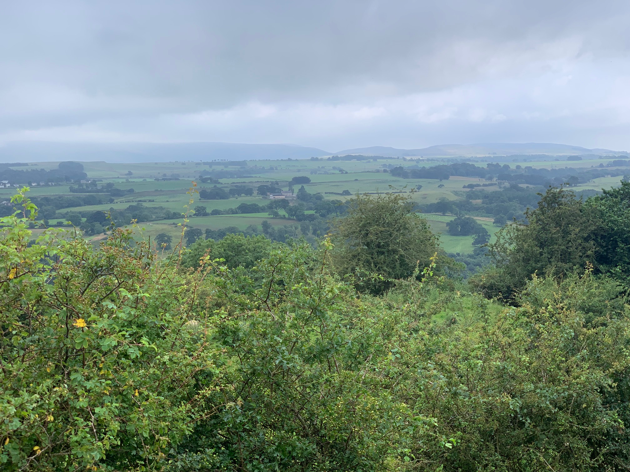
Other. ** 2 stars. If you look southwards, you see a magnificent panorama across the southern fells.
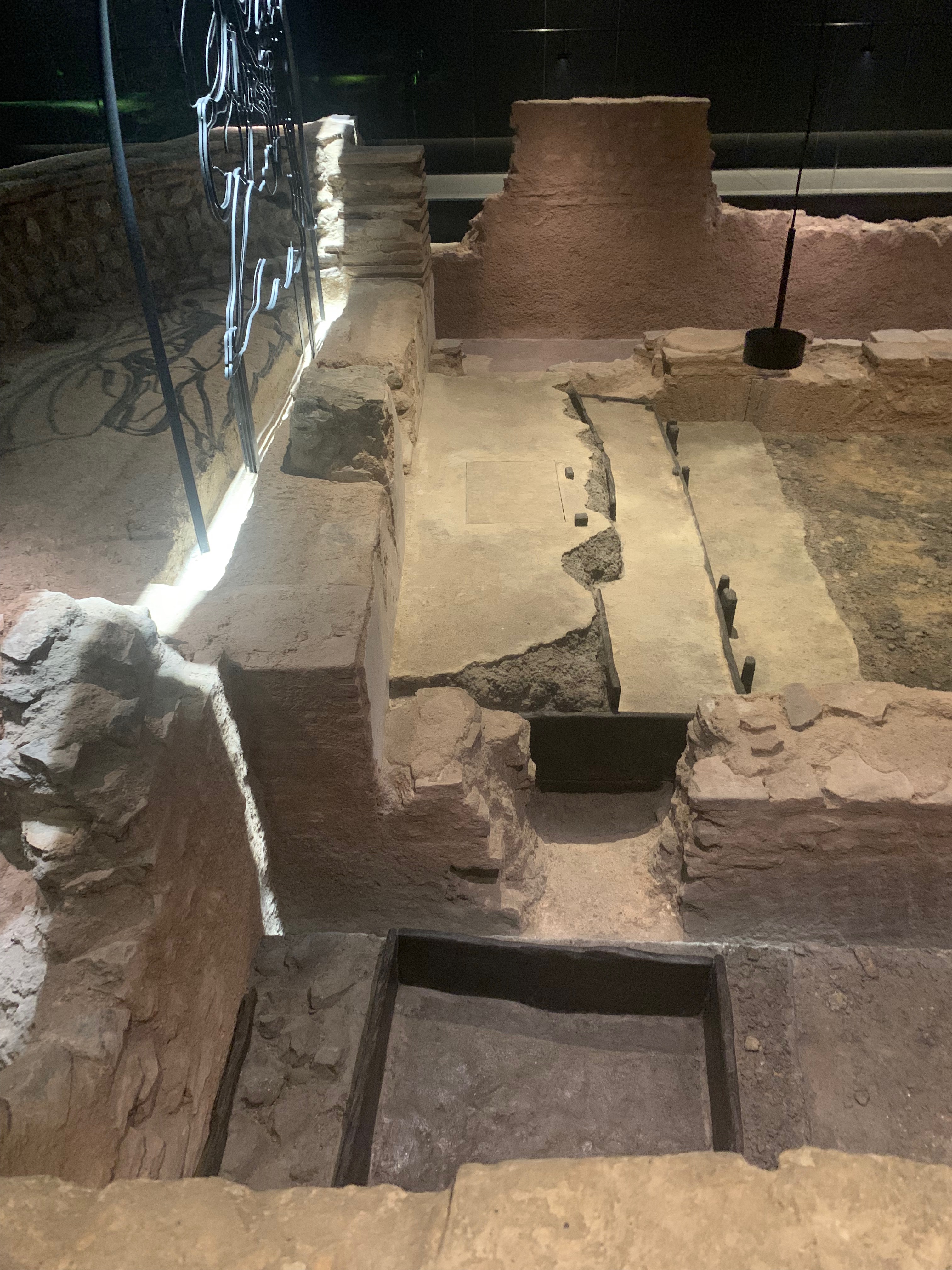
Pike Hill Turret was designed as a forward lookout in the years before the Wall itself was constructed.
Pike Hill Turret remains looking North.
In the reign of Trajan (Hadrian’s predecessor) the Stanegate was the frontier of the Roman Province. Forts on the Stanegate situated in the valleys of the River Irthing and the River Tyne needed ‘eyes’ up the northern slope – hence the construction of this small forward lookout with wide views from which troops could communicate with the Stanegate fort at Nether Denton.
Wide view to the South from Pike Hill Turret
Once Hadrian’s Wall was being constructed Pike Hill Turret was subsumed in the wall line (but not allowed to interfere with the new “milecastle and turret” scheme). Presumably it stayed in use and could now also communicate along the Wall.
Overall Impact **** 4 stars – Housesteads has ‘star quality’, given its position atop the crags and on a slope that faces you as you approach.
Access ** 2 stars – it’s a long trudge up from the National Trust carpark, although it provides spectacular views of the fort in its context (although disabled parking at the top of the hill can be arranged at the information centre for those who require it). It can be windy and uneven underfoot.
Atmosphere ***** 5 stars – it’s not difficult to imagine you are a one of the Tungrian soldiers stationed there, gazing out into the drizzle to spot raiders or smugglers!
Other ** 2 stars – the famous latrine provides a good source of lavatorial humour for children of all ages!
For many people, Housesteads is the quintessential Roman auxiliary fort and it is definitely ‘the fort to see’ on Hadrian’s Wall. However, as always, when you dig into things with the Roman Army, it’s not quite that simple…
Housesteads was one of the forts built as a result of the ‘Fort Decision’ in around AD124 when the Roman High Command decided that – instead of a thinly-held ‘curtain’ along the new frontier with turrets and milecastles communicating with forts in the rear along the Stanegate Road – it was necessary to man the border with troops of all kinds, ready to be deployed forward aggressively. At the same time, probably, the decision was taken to narrow the wall from a massive 10ft to 6ft. Wall expert David Breeze estimates that troops on the front line increased from c3,750 to c11,000.
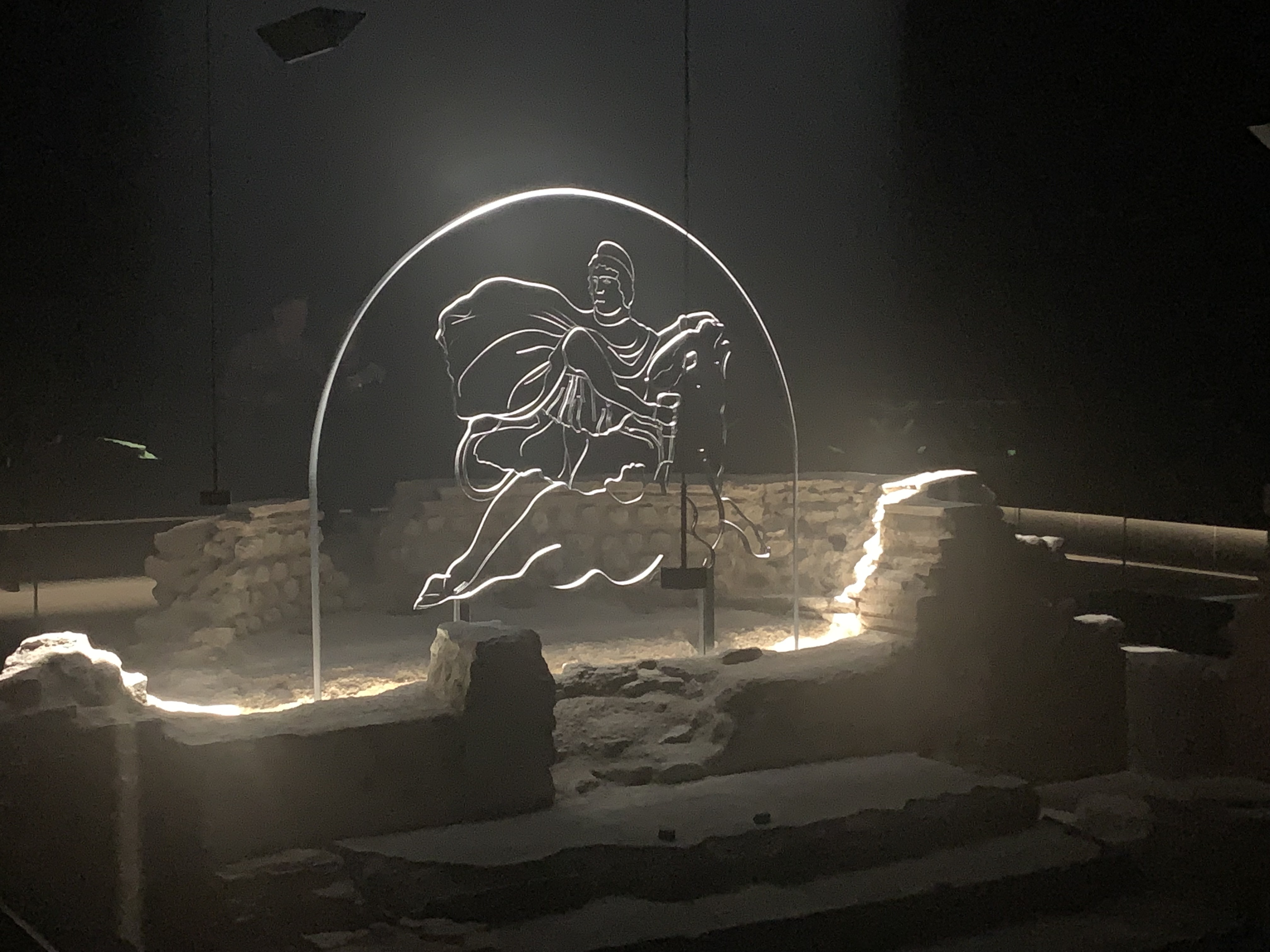
Panorama views looking north from the wall of Housesteads Fort
Part of that deployment was the deployment of a thousand-strong infantry cohort (Cohors Peditata Milliaria) to Housesteads. This involved the knocking down of a part-constructed turret which can be seen in the northern part of the fort, outside the granaries and just inside the fort wall which was then pushed as far towards the edge of the cliffs as possible, making the North Gate meaningless and purely decorative. But they still built it – after all, this is the Roman Army!
English Heritage have provided excellent reconstructions to bring the site to life.
Since it contained 10 centuries of 80 men each (800 in total), the fort is larger than normal at 2.2 hectares. There were 10 infantry barrack blocks: 5 west of the central range and 5 east, each row containing an additional workshop building. In the central range, stood the usual HQ (Principia), this time facing east along the long axis, with two substantial granaries to the north, and a magnificent house (Praetorium) for the Commander and his family, with a Hospital behind. All of these were built on a steeply sloping site, exposed to the frequent wind and rain of the Northumberland weather. So the ‘poor bloody infantry’ got Housesteads Crags, whilst the better-paid elite cavalry got the bucolic pleasures of Chesters in the North Tyne Valley.
The twin Granaries from the original Hadrianic fort, subsequently modified and knocked together.
We don’t know which unit was lucky enough to get this windy posting: clearly being ready at short notice to deploy aggressively north of the Wall was vital – why else put them here? However, along with the rest of the Wall, all this site was dismantled or moth-balled after Hadrian’s death in AD138, and Antoninus Pius’ decision to move the frontier forward to the Clyde-Forth Isthmus and to what become the Antonine Wall. So could we look on the 50 years of Hadrian, Antoninus Pius, Marcus Aurelius and Lucius Verus from AD117 to 167 – far from being the Golden Age of the Roman Army – as being instead an era at least of indecision and waste of effort, or even of failure?
When the Army came back to the Wall in the early AD160s, the Housesterads garrison was the Cohors I Tungrorum which by now had a complement of 800 infantry. Originally recruited as auxiliaries from the native Tungri of Belgica, they had been stationed at Vindolanda in the late 1st Century, and by the AD180s would have become thoroughly local on the Wall. They were augmented by barbarian irregular infantry from ‘free’ Germany (Numerus Hnaudfridi) andcavalry from Frisia(Cuneus Frisiorum), presumably recruited to provide a certain ‘barbaric’ edge to the Tungrians’ regular tactics.
Amazingly, the Tungrians were still there at Housesteads by the time of the Notitia Dignitatum in the late 4th Century. However, by then the neat barrack blocks had been divided up into what have been somewhat weirdly named ‘chalets’, one replacing each previous set of contubernia rooms. Some people think this reflects the decline of the Roman Army, with families moving into the ‘chalets’ along with the soldiers. But at Housesteads there is very little evidence for this happening (unlike at Vindolanda), so the reason for the rebuild remains unclear.
Visiting the Site
You stand a good chance at Housesteads of being blown away, drenched or at best slightly dampened by the Gods of the Northumbrian Weather. However, there is plenty exposed on the site from different periods which is well worth seeing.
Rather excellent model of Housesteads Fort as built.
The best plan is to visit the Museum (housed in the old farm buildings) on your way onto the site. Here are some key finds from the fort plus a really good model of the fort as it was built in the AD120s and some excellent pictorial reconstructions of the whole fort and its key buildings. What is most striking is how the Roman architects did not let the sloping nature of the site get in the way of laying out the regulation plan; and how much effort was put into constructing a multi-storey Commander’s House with a central courtyard – great in the Mediterranean but probably a source of flooding up here.
Badge of Office – possibly of a Beneficarius Consularis an official on the Governor’s Staff – in the Housesteads Museum
It is worth then visiting the (pointless) North Gate to look over into the Barbarian lands and a view for miles north, and to gaze west and east along the Wall that bestrides the crags. And in the north-east quadrant you can see the ‘chalets’ laid out in their irregular plans.
As a final treat, everyone visits the south-east corner to marvel at the Roman latrines, which were flushed by the plentiful rainfall at Housesteads. Apparently, though, the plumbing is not so clever and effective as it looks…
Overall Impact **** 4 stars – One of the most unusual Roman forts to be found in Britain. Started off quite normal but then became the supply base for Septimius Severus’ campaigns in Scotland and thereafter for the garrison of Hadrian’s Wall – unique!
Access *** 3 stars – One of Tyne and Wear Museum Service flagship sites, Arbeia is well branded and signed. There is parking outside plus extensive beach-side car parks. (It takes some time to drive to South Shields from Newcastle, however, either through the Tyne Tunnel or by heading south down the A1 and then back up.)
Atmosphere ***** 5 stars – The Fort feels special: it has been a “People’s Roman Park” since the 1870s when the central area was exposed, and the 3 amazing reconstructions (the West Gate from AD160s, 3rd century barracks and 4th century Commander’s House) are very evocative.
Other **** 4 stars – Don’t miss the two high-quality tombstones of Regina and Victor probably carved by a Syrian craftsman in the small Museum. (The Bookshop sadly did not, however, seem to include a current Guidebook to the site when we were there.)
The tombstones of Regina (on the left) and Victor (right).
One of the most unusual forts – well worth making the effort to visit, in the Hadrian’s Wall Region or Complex but definitely not ‘on the Wall’, is South Shields or ‘Arbeia’ as it is branded at the site and on signposts.
The brightly painted Courtyard of the Commander’s House from the 4th Century.
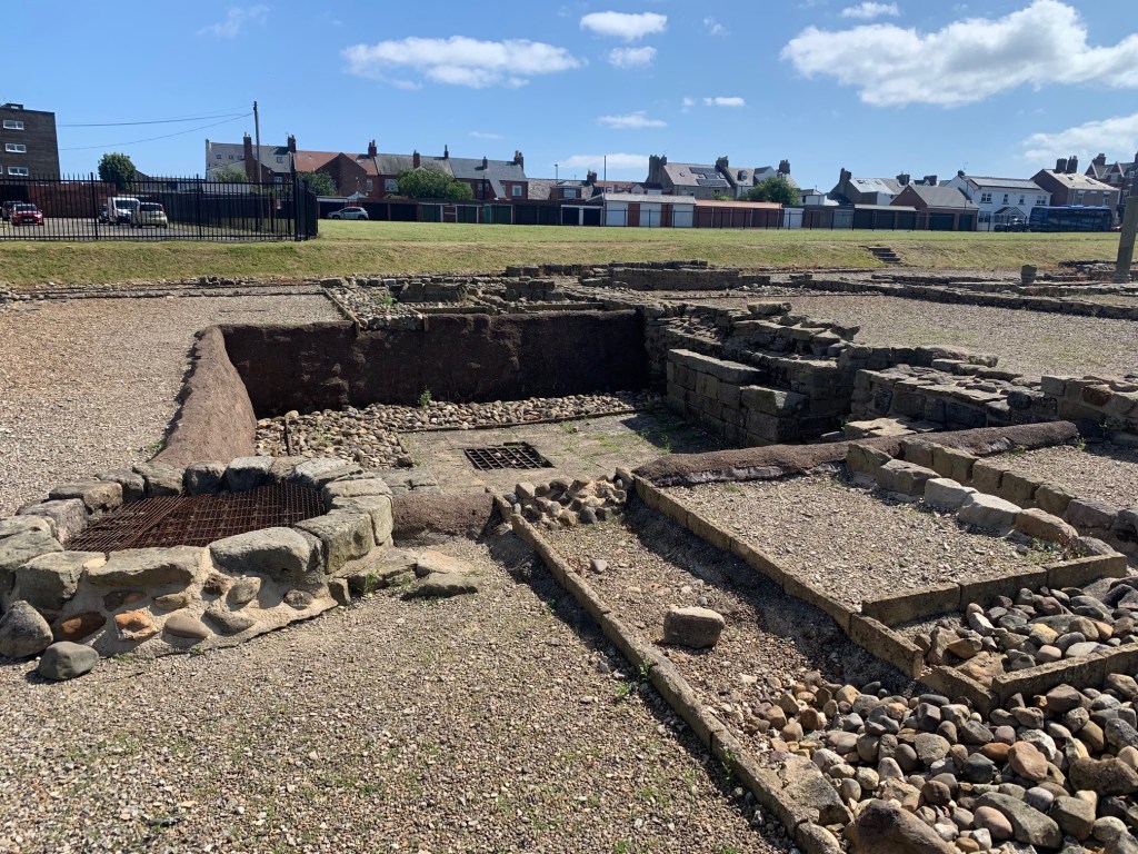
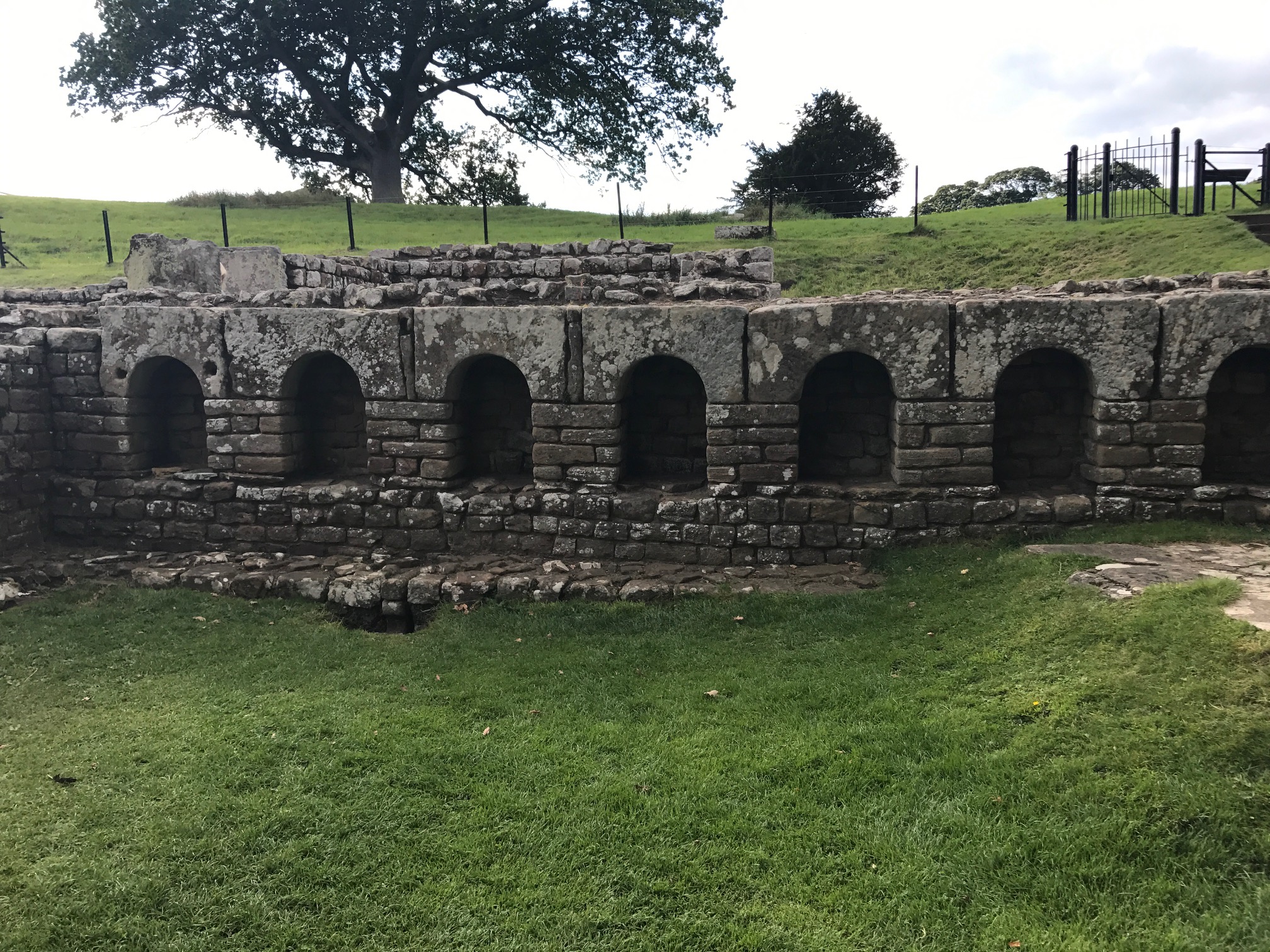
It was built as part of the Antonine re-occupation of the Tyne-Solway line in the early 160s and is a ‘bog standard’ auxiliary fort for a Cohors Equitata Quingenaria). In the middle range stands the Headquarters (Principia), facing north, with a pair of granaries to the west and the Commander’s House (Praetorium) to the east. In front of them there appear to be 6 barrack blocks (6 x 80 men = 480 infantry) and behind there are 4 cavalry barracks with urine pits for the horses in the front rooms of the conturbernia (4 x 30 = 120 troopers), housing a total of 600 troops. It feels like the twin of Wallsend built in the late AD130s and reoccupied at the same time as South Shields in the AD160s.
South Shields gets really interesting in AD207 when the fort is converted into a supply base for Septimius Severus’ campaigns in Caledonia. The fort is extended to the south and a dividing wall erected across the middle. The old Principia is demolished and a new smaller one, now facing south, is built. The barracks are removed and an amazing 13 new granaries are built which, with the two existing ones, gives 15. The poor old garrison unit Cohors V Gallorum is therefore jammed into the southern half of the site in shortened barrack blocks.
The exceptionally large Strongroom in the Principia – the largest in Britain – presumably for storing the pay chests arriving for the Wall garrisons.
This scheme is never finished and the dividing wall is knocked down, still more granaries built, bringing the total to 22, and some more barracks are crammed into the south-east corner.
South Shields continued as a Supply Base for the Army on Hadrian’s Wall after the departure of Septimius Severus and his son (and fellow Augustus) Caracalla. Another new Principia was built and some short barracks replaced the previous ones. This role continued during the 3rd Century with grain imported from northern Gaul. Interestingly in the Notitia Dignitatum from the late 4th Century the garrison is a unit of Tigris Boatmen or Bargemen from present-day Iraq). It is an attractive theory to see these troops arriving with Septimius to transport grain and supplies up the coast to the Army in the north and staying to distribute supplies up the Tyne to the Wall garrison afterwards. Severus had previously been campaigning in the East and had created the new Province of Mesopotamia with its frontier on the Tigris. The name Arbeia is thought to be a version of ‘Arabia’ relating to this deployment. The freedwoman Regina, whose tombstone was found in the civilian settlement (vicus) here, was the wife of Barates from Palymra. Barates himself is thought to be buried at Corbridge (Coria) behind the Wall.
A disastrous fire around AD300 destroyed the fort, cause unknown. In the resultant rebuilding, eight of the granaries in the south were converted into barrack blocks, each with space for 5 conturbernia (5 x 8 men = 40), housing a total of around 320 men. The Commanding Officer of this unit – and this may be when the Tigris Bargemen were in fact deployed here – had a large, even palatial, Praetorium complete with integral bath suite and both summer and winter dining rooms. Arbeia seems to have functioned as the supply base for the Wall through the 4th Century until the breakdown of the imperial pay- and supply-chains in the early 5th century. It may well have become a centre of royal Northumbrian power thereafter.
Reconstructions
So, for everyone interested in Roman forts, this complex evolution is ridiculously interesting. And now you can add to that the three – yes, three – unique reconstructions that Paul Bidwell and the Tyne and Wear Museums Team have built.
Fort Gateway
The reconstructed West Gate leading to the presumed docks, originally built c160AD.
The West Gateway has been reconstructed on its foundations to its full imposing height, something which is quite common along the German Limes but scarcely ever happens in Britain. Opened in 1988, faithfully reflecting the stone fragments found on site and using Northumbrian stone externally, it brings home to visitors and school parties just how imposing a Roman fort was in the landscape. The new version has weathered its 30 years in the Tyneside climate very well.
Barrack Block
The reconstructed barrack block is one of the new types of the 3rd Century with 5 contubernia plus officers’ quarters at one end. Unlike the robust Gate, the barracks building brings home to modern eyes what a rotten, cold and often soaking wet life a Roman auxiliary led. It is built of clay-bonded stone and mud plaster coated with limewash, with internal partitions of wattle and daub. If the unit was up to strength then these rooms would have been crowded with up to 8 men and all their kit, and smoke-filled from cooking and heating. The reproductions – probably like the originals – are not surviving well in the Tyneside weather, with plaster flaking off.
A crowded rear room in one of the conturbernia.
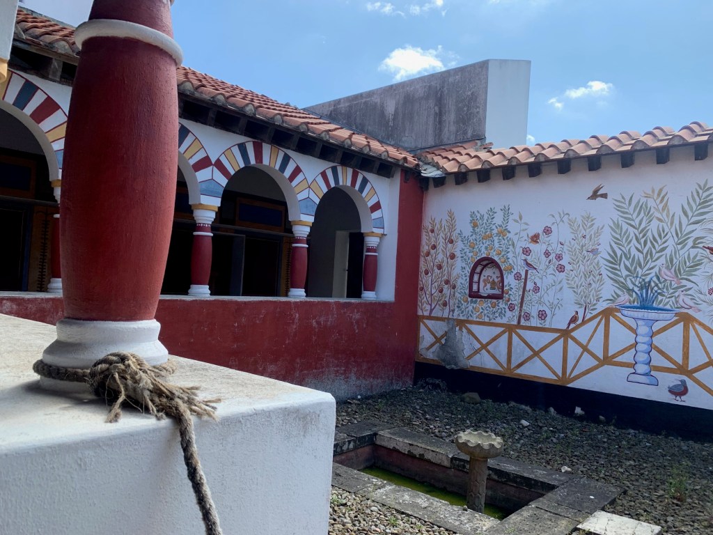
Commander’s House from the 4th Century
Next door to the crumbling barracks is a recreation (on the original foundations) of the unique Commander’s House from the 4th Century. It is decorated with tremendous panache and joie de vivre in bright colours with what to modern eyes look like naive fake painted marble and portraits of the Emperor. This suggests at what you could achieve even in the the far north-west of the Empire with local craftsmen.
The portico leading to the Summer Dining Room.
There are store rooms, the Commander’s study, two bedrooms, a vast summer dining room and a painted courtyard. Yet this still leaves the winter dining room, with extra heating, and the bath suite not reconstructed! Only the top man and his family lived in such luxury…
Commander’s Bedroom.
The Commander’s House is showing some wear and tear, but its impact is still like no other reconstruction we have seen. Interestingly, the reproduction Roman tiles (tegulae et imbrices), manufactured specially in Italy, let in the rain – given how they were first fitted – leading to the collapse of the painted ceiling in the dining room!
Reproductions of Late Roman furniture.
Museum
In the small but good Museum there are two high-quality tombstones probably carved by a Syrian craftsman. They are both rightly famous and provoke so many questions about the nature of society and relationships in Roman Britain. One is to Regina, a freedwoman and the wife of Barates – he was from Palmyra, she was from the Catuvellauni living around St Albans. The second is to Victor who died at 20, a former Moorish slave freed by Numerianus of the Ala I Asturum who arranged his funeral ‘with all devotion’. There is also a good range of other finds from the site.
Overall Impact: **** 4 stars – One of the best ways to get a feel for a ‘standard’ Roman auxiliary fort: you can examine the gates, Principia and baths and understand how they worked.
Access ***** 5 stars – As a prime English Heritage Hadrian’s Wall site, it is well signposted from both directions, with the AD122 bus stop plus ample car parking space, and good visitor facilities. Most areas of the site are easily walkable.
Atmosphere ** 2 stars – In the absence of anything other than walls and information signs, you need to use your imagination to recreate the fort. But there are good children’s activities which help with that.
Other *** 3 stars – Clayton Museum at the site has been beautifully restored to its nineteenth-century splendour. As a bonus, across the River North Tyne is the surviving bridge abutment.
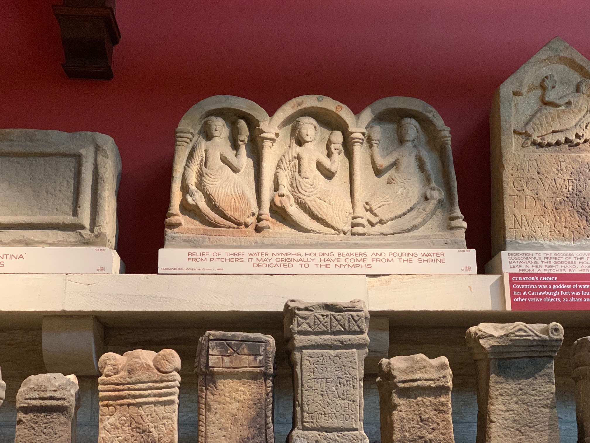
The ‘Matres’ in an inscription in the Clayton Museum
Chesters (Roman Cilurnum) was one of the forts built on the line of Hadrian’s Wall when the original conception of a wall composed of milecastles and turrets was abandoned and the decision was taken to move forts from the Tyne Valley forward to the line of the Wall itself. Given that the Wall was begun in AD122, Chesters therefore dates from a few years thereafter: English Heritage plump for a date of AD124. The ditch in front of the Wall was filled in and a turret that had just been built (or at least started) on the site was demolished.
Statue of Juno Dolichena, consort of Jupiter Dolichenus, standing on a heifer, wearing Eastern garb – the cult originated in Syria. Statue is in the Clayton Museum and was found at Chexters.
The original Hadrianic garrison was Ala Augusta ob virtutem appellata, that is, the Cavalry Wing or Regiment Awarded the Title Augusta for its Valour. As a cavalry regiment it was one of the most prestigious units on the Wall, and had landed a delightful billet beside the River North Tyne in what was probably, then as now, a fertile and attractive spot. A cavalry ala had 16 squadrons (turmae) of 32 men and their horses.
Probably abandoned or mothballed during the move forward in the Antonine period, by AD178-84 the fort garrison was Ala II Asturum, a cavalry wing originally raised in Northwest Spain who were there throughout the remaining lifetime of the fort into the 4th Century. At this period the buildings inside the fort were completely rebuilt. Interestingly, there seems not to have been space inside the fort for the 16 barracks needed for the 16 Squadrons of an ala: either the Ala II Asturum only had 12, or perhaps the remainder were on detached duties elsewhere in the Province and only rotated through Chesters?
The late 2nd and early 3rd Century were the heyday of Chesters with a large civil settlement (vicus) to the South and many inscriptions raised. However, the nature of the fort would have completely changed over the period AD250 to 350 with the vicus largely disappearing and the civilians moving into the Fort. The garrison would have been drawn from the sons of serving soldiers as was compulsory in the Late Empire. An inscription from AD286 refers to irregular troops (symmacharii) also being present at Chesters.
Principal Visible Remains
Excavations were carried out by landowner John Clayton in the 19th Century, so what we have are the surviving walls plus the inscriptions and sculptures now displayed in the charming Museum. Four Hadrianic gates excavated by Clayton (out of the total of six) are exposed: the original double entrances were not needed, or were too insecure, and one of them was blocked early in all cases. Was this to facilitate security checks on those passing through, or due to a realisation that the ability to deploy horsemen quickly through three double gateways north of the Wall was not in fact needed?
The South Gate with double arches, one comprehensively blocked.
The Hadrianic headquarters building (Principia) is large, as befits an elite Ala, and gives a good impression of what a fort HQ was like, with the vault of the strongroom, opening off the central Shrine of the Standards, still surviving. The layout of the Commander’s House (Praetorium) defeats explanation and will continue to do so, given when and how it was excavated. However, the Commander clearly enjoyed his own bath suite.
The Arch of the Strong Room opening off the Shrine of the Standards in the Principia at Chesters.
Most of the rest of the interior is unexcavated. The key visible remains are the two opposing barrack blocks. Based on comparison with German forts and excavations at Wallsend, these are now seen as two-storey buildings. The current view is that there were 10 contubernia which each housed 3 horses in the front room and their riders in the back room (although we prefer the idea that the men slept upstairs, leaving equipment and possibly grooms in the back room). This would allow for 30 men and riders in a squadron (turma), with their commander (optio) and the Standard Bearer in the larger end rooms.
View of the Baths from up the slope towards the Fort – River North Tyne in the background.
The star surviving remains are the garrison Baths, between the fort and the river. They are Hadrianic but heavily modified They famously have niches (possibly for clothes) in the large changing room, plus a surviving base of a window, stone channels with lead seals still remaining, and a latrine on the riverside. These bath would have been a welcome luxury for the elite soldiers stationed at Chesters.
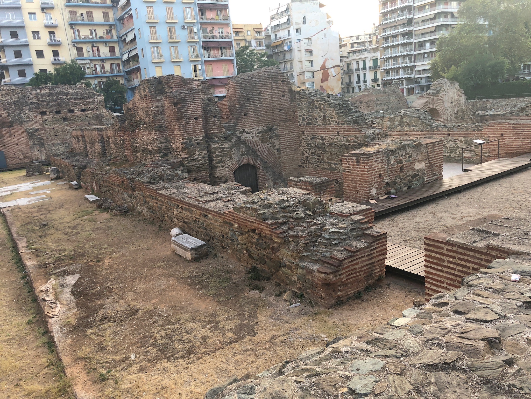
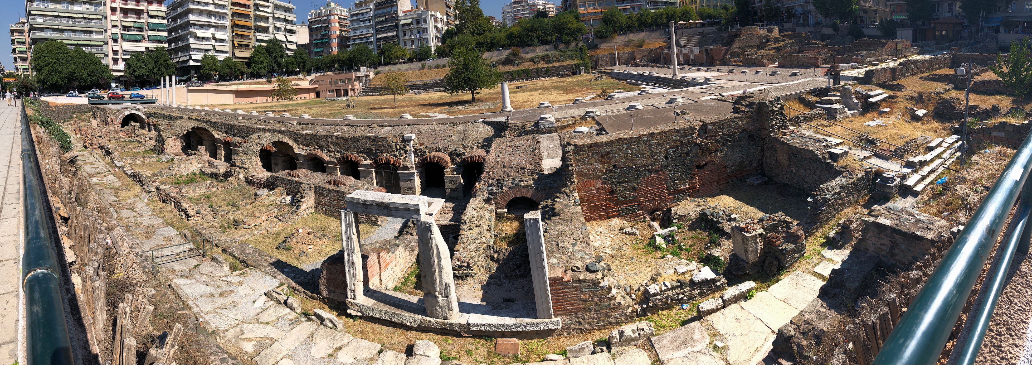
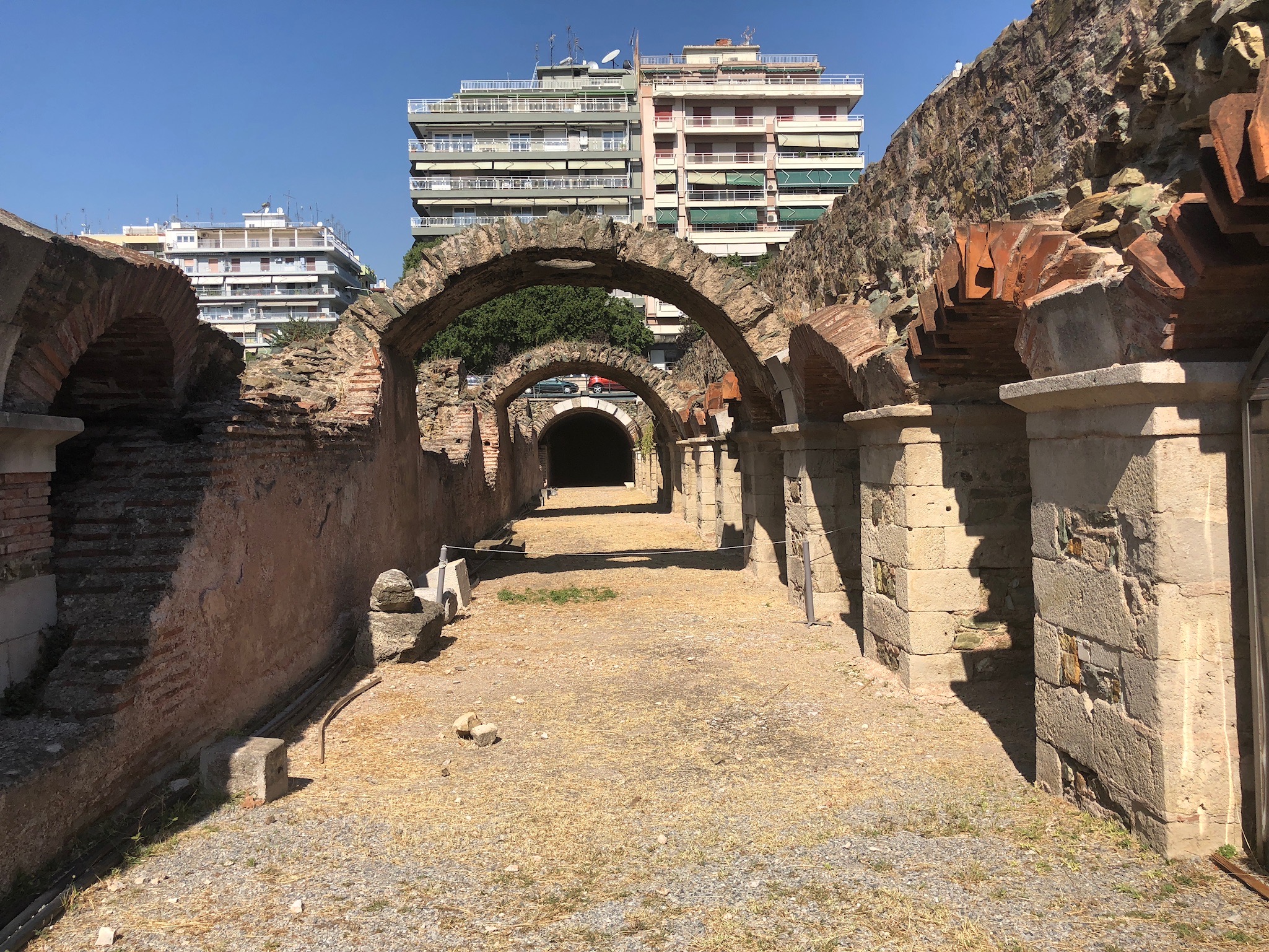
Overall Impact: *** 3 stars – Galerius’ Palace impresses through its scale but, having been incorporated in the medieval and Ottoman city, the Roman remains consist of foundations and walls.
Access **** 4 stars – As with the other sites in Thessaloniki the site is well cared for and curated, and is only a short walk southwards from the Arch of Galerius toward the sea.
Atmosphere ** 2 stars – You will need to use your imagination to recreate the Roman Palace. It is overshadowed by modern housing, but hats off to the City Fathers for displaying such important remains in an area where space is tight.
Other *** 3 stars – OK, it’s not Diocletian’s Palace at Split, and it’s in a busy city and hard to visualise, BUT it is Galerius’ Palace in Thessaloniki and very much worth seeing!
The above photo shows the remains of Galerius’ Basilica or audience chamber, with the nave to the left in front of us. We should be thinking here in terms of Constantine’s Aula Palatina which survives at Trier.
We can see here – above and below – the remains of the Peristyle Hall, with 11 rooms arranged round a courtyard with a fountain.
Above are the exposed remains of the Apsidal Hall. This was a magnificent part of the Palace between the Arch and the Basilica. It has two rooms and ended in a raised niche: was it a more private and intimate Throne Room? It had rich decoration with white and coloured marble on the walls.
Marvellous reconstruction by the Ephorate of Antiquities of Thessaloniki City, which can be found at galeriuspalace.culture.gr At bottom was the Rotunda or Mausoleum, then a porticoed way to the Arch of Galerius, and then another portico way lead to the Apsidal Hall, which in turn lead to the Basilica with the Circus to the left (west) and the Palace Complex to the right (east).Another marvellous Plan by the Ephorate of Antiquities of Thessaloniki City, to be found at galeriuspalace.culture.gr They rightly won European awards for the quality of their restoration and public explanation. The idea of making visible the Late Roman City of Thessaloniki originated with the plans for the Reconstruction of the City after the disastrous fire of 1917.
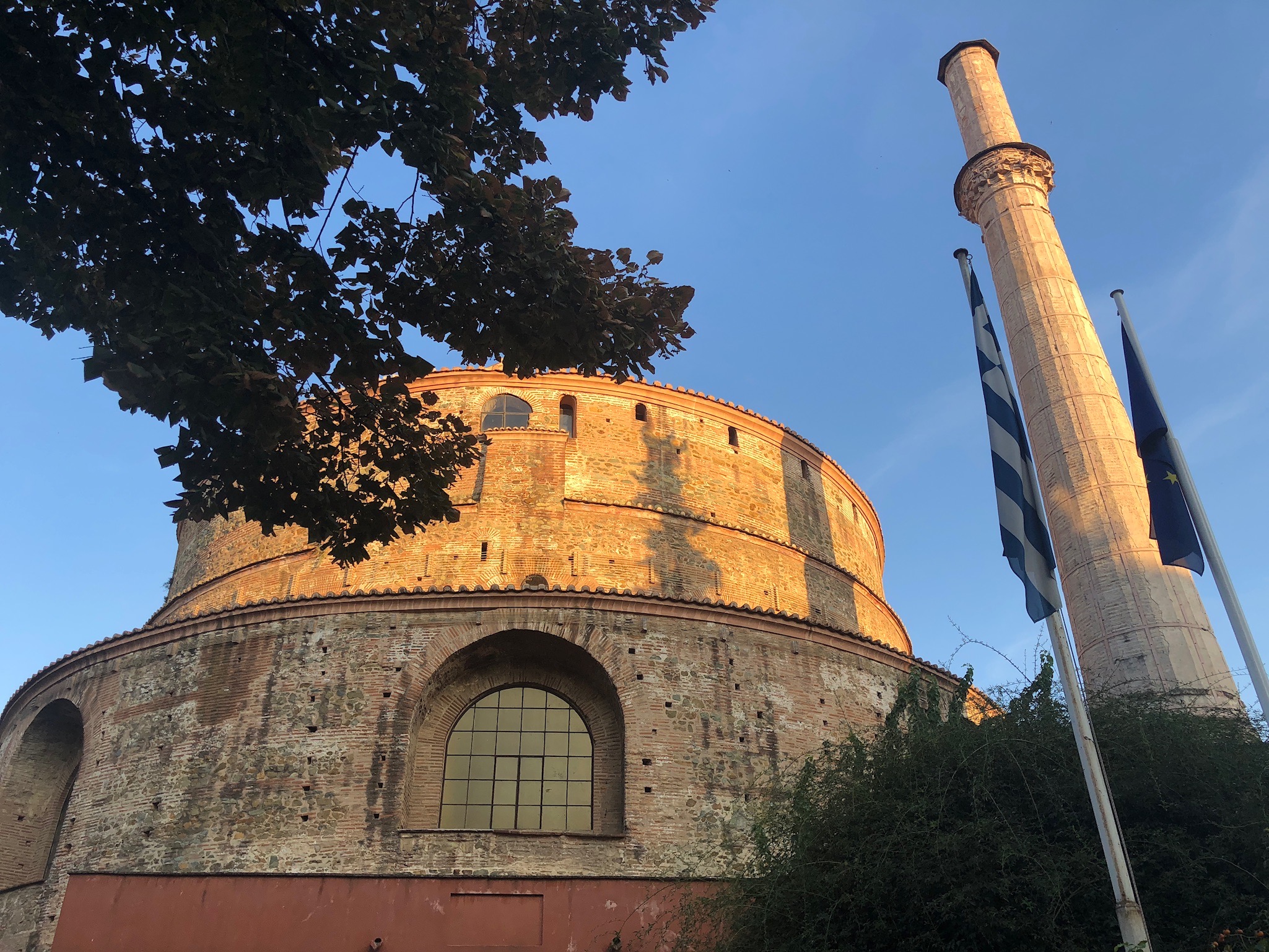
Overall Impact: ***** 5 stars – Less well known than the Arch of Galerius but has the impact of the Pantheon in Rome. A unique survival (and a marvellous surprise to us!)
Access **** 4 stars – Situated a short walk (125m) north of the Arch and, unlike the Arch, in a quiet side street. Recently restored and now open to the public.
Atmosphere *** 3 stars – C5th mosaics only partially remain. Damaged during the Mausoleum’s period as an Ottoman Mosque, they have now been wonderfully restored.
Other ** 2 stars – There is no good guide book on sale at the site – but do check out local book shops for a scholarly exposition which we happened upon. No good post cards available.
The Rotunda of Galerius is north of his Arch: built in AD306, it is usually thought to have been intended as his Mausoleum. However, when in AD311 Galerius died hideously from a disease usually interpreted as gangrene, he was buried at Felix Romuliana (Gamzigrad in Serbia), his birthplace. Therefore it probably never fulfilled its intended function.
The Rotunda’s dome is 30m high and is one of the largest surviving from the Empire. The walls are extremely thick, explaining how it has survived earthquakes through the centuries.
East End Apse added when Mausoleum converted into Church in late C4th
It was empty until Theodosius I had it converted into a church in the late C4th. It was then decorated with some very fine mosaics apparently depicting prominent members of the Thessalonica community, rather than Imperial portraits.
The church was turned into a mosque by the Ottomans in 1590. It was re-opened after extensive restoration in 2015, as a Museum.
Overall Impact: *** 3 stars – the Arch is much reduced and damaged by atmospheric pollution. We approached with anticipation but were disappointed by its poor condition – nevertheless, it is a major statement of Tetrarchic power and ideology.
Access **** 4 stars – the Arch sits on what was in Galerius’ time and still is the main street of the City. Accessible 24 hours a day but be alert for traffic and touts.
Atmosphere * 1 star – it feels like a traffic island!
Other * 1 star – there is only perfunctory explanation of what is a major late Roman monument, and its condition is deteriorating exposed to high levels of street pollution.
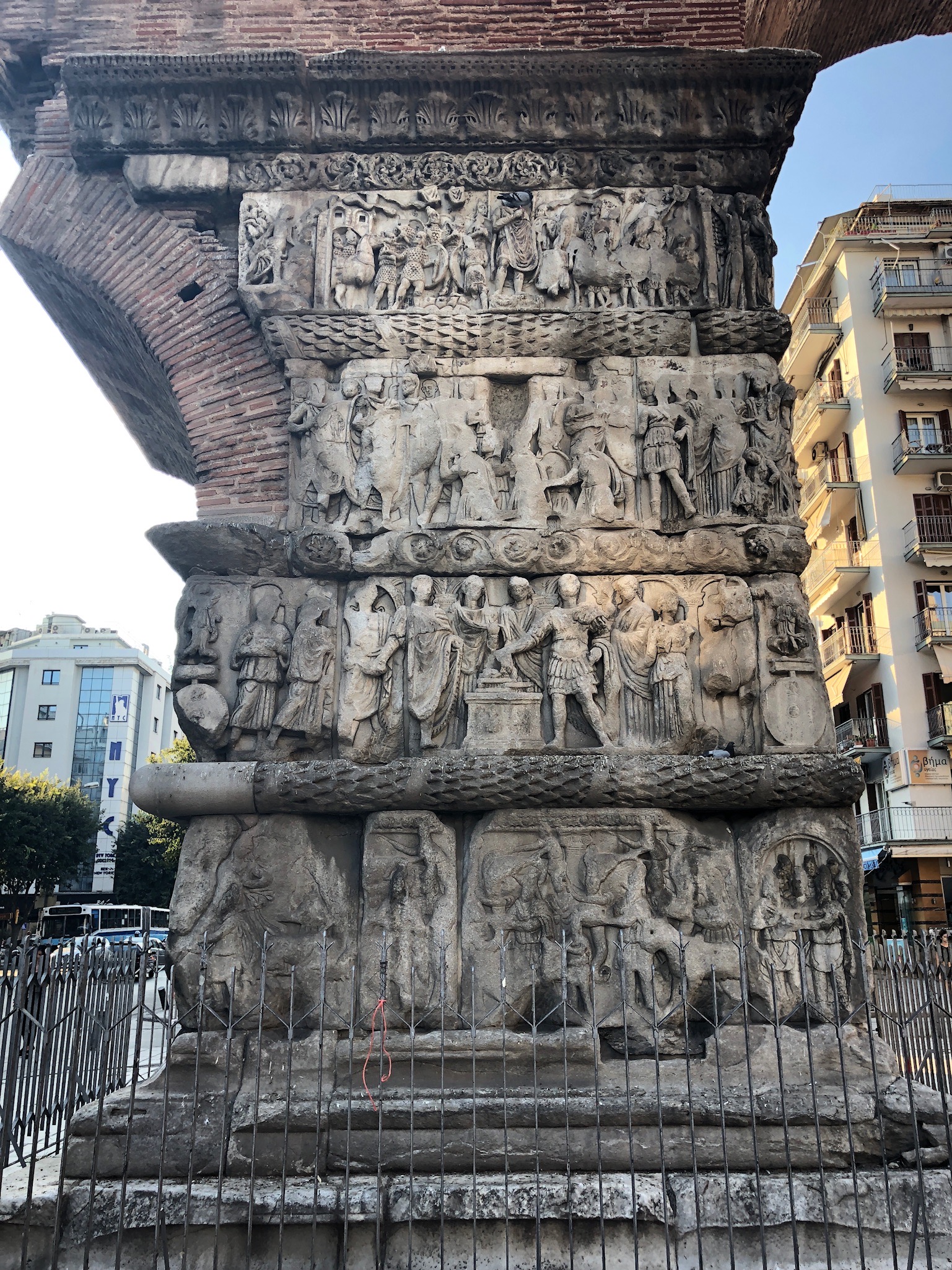
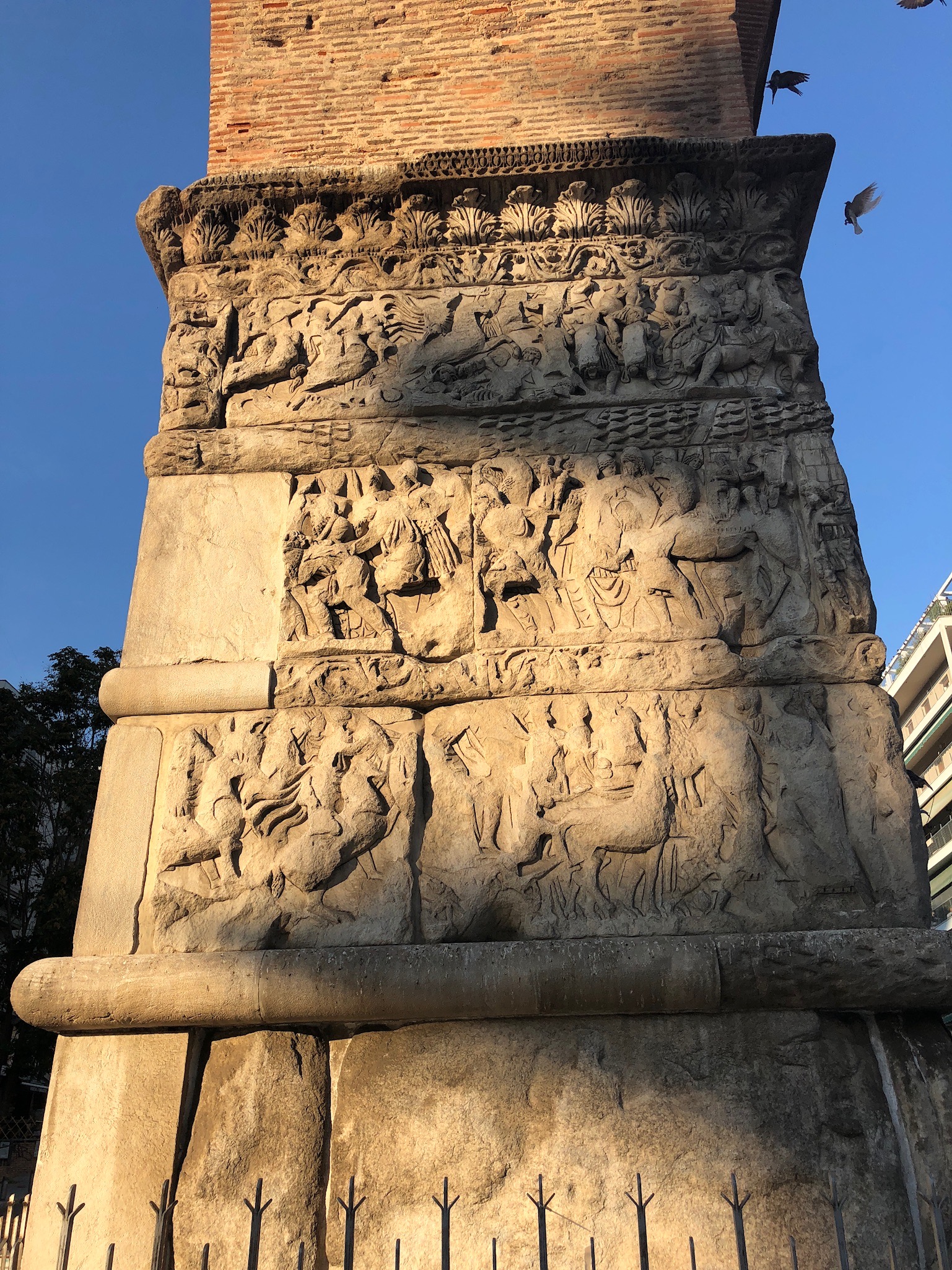
There are three linked remaining monuments of Galerius’ Imperial Precinct in Thessaloniki. The Arch sat across the Via Egnatia‘s exit from the City to the East towards Byzantium. The Imperial Palace lies 230m south of the Arch linked by a road, and the Rotunda Mausoleum lies 125m to the north linked by an arcaded road.
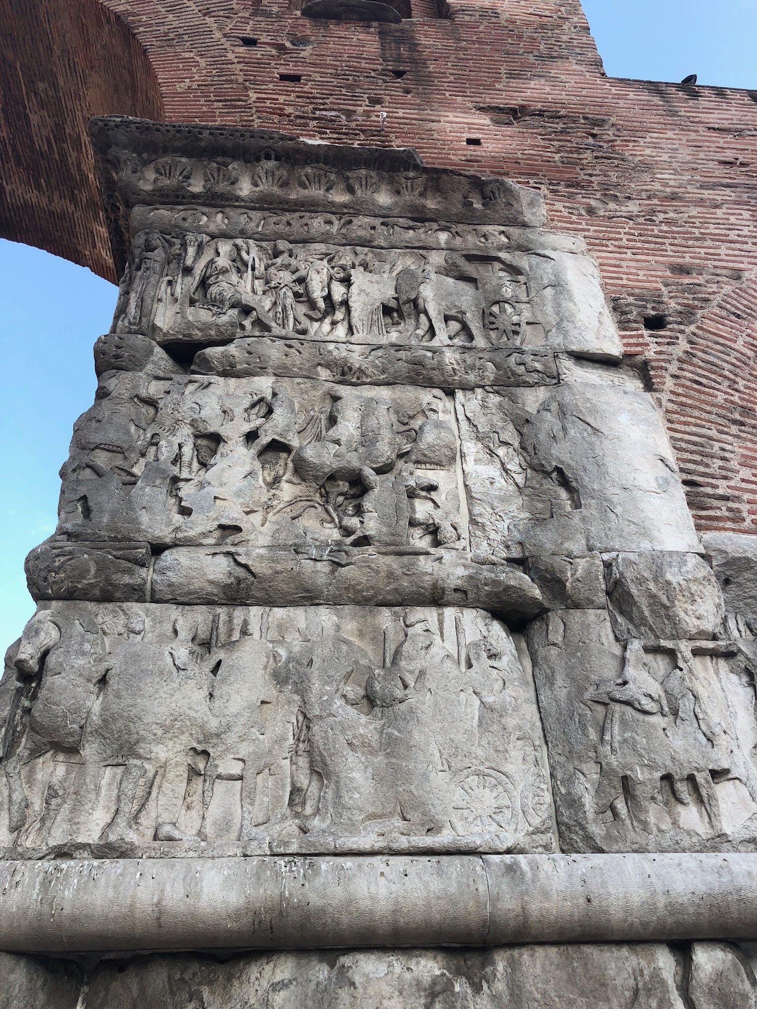
The Arch was an octopylon or eight pillared gateway, forming a triple arch (one central large arch, and two smaller side arches) with four pillars to the east and four to the west. All that is left are three of the western arches. The entire eastern four arches are gone as is the southernmost of the western arches. The two pillars flanking the central large arch retain their sculptures slabs.
The Arch celebrates Galerius’ victory over the Sassanids at the Battle of Satala and the capture of their capital, Ctesiphon, in 298AD.
Our ability to understand the meaning of the Arch is impacted by the loss of the majority of the marble panels. They show:
Galerius, supported by a wreath bearing eagle, in personal mounted combat with the Sassanid Narses, with terrified Sassanids cowering under the hooves of the Caesar’s horse. This may be artistic licence, however, as it seems unlikely they ever personally met in combat.
There is panel with a relief of the Imperial Family making a sacrifice in thanksgiving. This shows Valeria, who was former Emperor Diocletian’s daughter as well as being Galerius’ wife, giving him imperial legitimacy.
In another survivor panel the four Tetrarchs (the Augusti Diocletian and Maximian, and the Caesares Galerius and Constantius) are all in togas, while the personification of Victory holds out wreaths to the two Augusti.
The final surviving panel assert the Unity of the Tetrarchy through the depiction of the Tetrarchs standing together. Galerius is dressed in armour as he makes the offering on the altar.
The Arch is thus a celebration of Galerius’ victory but one achieved very much within the unity of the then-new Tetrarchic System.
Overall Impact: ***** 5 stars – Roman Thessalonica is, with Trier, the ‘go to’ site for remains of a Tetrarchic and Late Roman regional capital. The Arch of Galerius, together with his Palace and Mausoleum, give a sense of the grandeur and power of what was essentially a militarised state. The earlier Forum is large and well displayed.
Access *** 3 stars – Thessaloniki is Greece’s second city and the sites are scattered around a busy modern metropolis. So they are easy to access, with plentiful refreshment stops – but expect to walk some miles in the sun!
Atmosphere ** 2 stars – You will need to use your imagination to recreate the Roman City. Crowds and traffic surround the Arch of Galerius, which is missing large parts and heavily eroded by pollution
Other **** 4 stars – There is something about Thessaloniki with its weight of Macedonian, Roman, Byzantine, Ottoman, Jewish and Greek history that gives it a special feel.
The preserved remains of the C1st Forum
Thessaloniki (Thessalonica or Salonica) was founded in 315BC by King Cassander of Macedonia, and named by him his wife (Alexander the Great’s half-sister) Thessalonike. In 148BC the City became the capital of the Province of Macedonia which the Romans had conquered in 168BC. In 41BC under Mark Anthony’s eastern regime the City gained free status.
The two Storey shopping arcade – nicely sheltered in Summer
The position of Thessaloniki is second only to Byzantium/Constantinople in the Region. The Via Egnatia from Dyrrhachium on the Adriatic to Byzantium on the Bosphorus runs through Thessaloniki. It is also at the southern Aegean Sea end of the principal north-south route through the Balkans along the Morava and Axios river valleys. It has a natural harbour opening onto sea-routes along the east coast of Greece and down to the Aegean Islands. Thessaloniki prospered greatly under the Principate and the principal visible remains of that period are to be seen in the Forum, which occupies a large area of the central City.
Having been a classical – in every sense of the word – Romanised Greek trading city during the Principate, the success of Christianity and the establishment of the militarised Dominate made Thessaloniki one of the most important imperial and therefore military bases of the late Empire.
The massive ruins of Galerius’ Palace
The principal remains of the Dominate, or Late Empire, result from the decision of Galerius to make it his capital under the Tetrarchy. Galerius was the trusted military colleague of the Augustus Diocletian and was appointed as his Caesar in 293AD. He successfully fought the Sassanid Empire, sacking Ctesiphon in 299AD, and defeated the Carpi across the Danube in 297 and 300AD. Like Diocletian an enthusiastic persecutor of Christians, Galerius belatedly issued the Edict of Toleration in 311AD before dying horribly, probably of gangrene – a fate celebrated by Lactantius in ‘The Deaths of the Persecutors’ (De Mortibus Persecutorum).
It is to Galerius that we owe the triumphal arch, palace and mausoleum which taken together rival Trier as the most impressive remains of a Tetrarchic capital.
St Demetrius, founded c450, rebuilt several times, severely damaged in Great Fire of 1917, and reconstructed thereafter.
St Paul had visited the City on his Second Journey, visiting its chief Synagogue on three Sabbaths, and writing the First and Second Letters to the Thessalonians. As Christianity grew in strength it attracted both attention and persecution: Thessaloniki’s patron saint is the military martyr Saint Demetrius who was run through with spears on the the orders of the Emperor Galerius in 306AD. The relics of Saint Demetrius probably only arrived in the City when Sirmium was given up as the Army’s northern frontier base in 441/2AD. The Basilica dedicated to him was built in the mid-5th Century but was, alas, severely damaged in the Great Fire of 1917.
In 379AD the Emperor Theodosius divided the great Balkan and Danubian Prefecture of Illyricum in half, the eastern part having its capital in Thessaloniki. This meant that the defence of the Danube Frontier was split and this, in my view, caused a fundamental strategic weakening of Roman forces and focus in the key sector of the Frontier. It was the cause of continued strife between the Western and Eastern Empires. It is a division that has lasted and still today forms the dividing line between Orthodox and Roman Catholic Christianity; Serb and Croat; Cyrillic and Latin script.
Interior of Saint Demetrius from mid C5th, rebuilt after Great Fire in 1913.
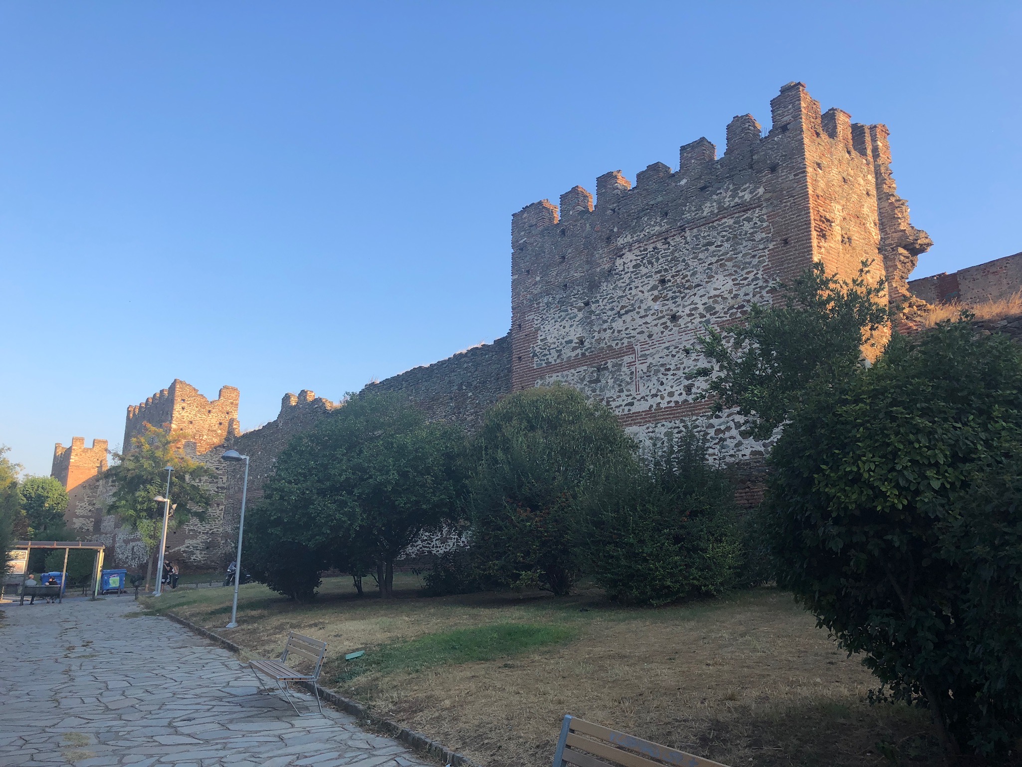
The monuments of this third phase of Roman Thessaloniki are chiefly the churches. Chiefly, there is the Basilica of Sant Demetrius which appears to date from the mid-5th Century, but there are also other survivals: the Churches of the Acheiropoietos and of Hosios David date from the 5th Century. There are also the City Walls which have survived remarkably except on the sea-facing side. Although much knocked down and repaired over centuries of sieges, their core is of Late Roman brick and ashlar of c390AD.
Overall Impact: ***** 5 stars – This is the best theatrical treatment of a Roman site we have seen. Using sound and light Bloomberg takes you as observers of a Mithraic ceremony from the C4th. What survives are basically the foundations of the walls – but you feel there is far more.
Access **** 4 stars – The site is in the new Bloomberg Building in the City of London with a reception area, art exhibition and wall-mounted funds display at street level. In the first basement is a waiting area with narrated commentary, and one level below that the actual Mithraic chamber. All floors are fully accessible by lift and step-free.
Atmosphere ***** 5 stars – With light effects creating the missing columns and walls, and the ancient invocation to Mithras in Latin coming though the sound-speakers, the impression of being at a Mithraic ceremony is wonderfully created.
Other **** 4 stars – This site really has a wow factor that other Roman sites in the UK don’t have. No wonder it’s a favourite with school groups (and public visits must be pre-booked in the summer).
The interior when the lights go up.
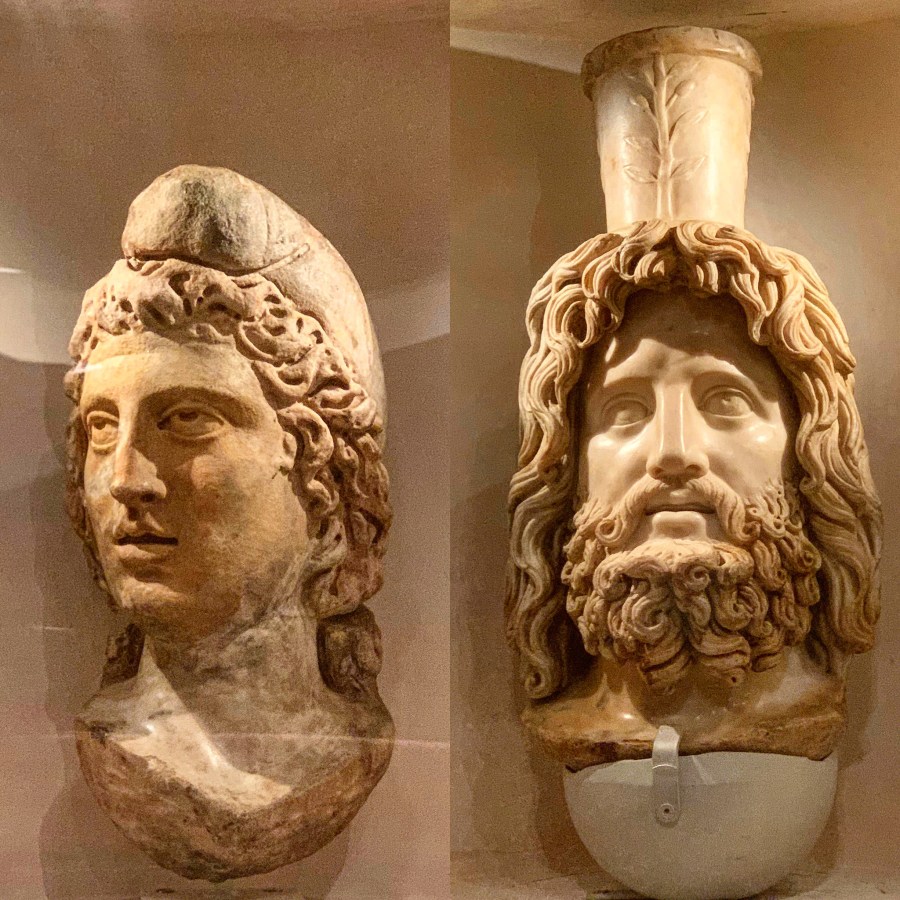
The Mithraeum was found in September 1954 during post-War bomb-site clearance around the course of the Walbrook River in the City of London. The site was originally on the east bank of the Walbrook. It was a major sensation when it was found with over 300,000 members of the public queueing up to visit the site. Amazingly high-quality statues of Mithras, Serapis and the bull sacrifice were found on the site, apparently buried in the 350s AD when the temple was given a new dedication to Bacchus.
The heads of Mithras and Serapis found buried in the Mithraeum. Serapis (right) is particularly fine.
By public demand, and after Questions in the House of Commons, the temple remains – which consisted of low-level walls – were transported some 100m away from their original location to an open-air site on Queen Victoria Street. The re-construction then was of the most basic kind, losing detail and plaster work, and was criticised at the time. The site remained there in wind and rain, a shadow of its former self, but remembered fondly by Londoners for its fame on discovery.
The reconstructed steps and the area behind the [modern] image of Mithras slaying the bull
In 2007 plans were formulated for the return of the Mithraeum to its original site. Given the pace of decay and renewal in the City of London, the post-war Bucklersbury House was due to be demolished and replaced by the new Bloomberg Headquarters. A full re-excavation of the Walbrook site was therefore undertaken. The waterlogged setting produced a wonderful variety of finds including organic remains and writing tablets with stylus impressions that have enabled messages to be reconstructed.
Bloomberg paid for the excavation and for the foundations of the Mithraeum to be moved back and this time properly re-constructed in their basement using the excavation reports and photographs from the 1950s as evidence. Plaster work was replicated and the physical remains returned to as near as possible their state when they appeared in the bottom of the bomb site. (Because there were some remains still in situ on the site, in order to protect these, the reconstruction still isn’t quite in the original spot!)
The best finds from the Walbrook site, on display in the Bloomberg Art Gallery at the entrance to the London Mithraeum – spear heads, household shrine, brooches, coins, writing tablets, steelyard, armour fastening, address on tablet and more armour fastenings.
Bloomberg then invested in a visitor experience with an art gallery at the entrance with a beautifully-designed wall display of the best finds from the Walbrook. These are carefully conserved and very well lit. And, for once, the iPad interactive catalogue is easy to use and adds real value to one’s understanding of the artefacts.
One floor down, there is a waiting area with audio-visual displays on the Cult of Mithras, from which the visitors are conducted down to a lower level where the Mithraeum is only dimly visible in the murk. There is then a 4-and-a-half minute son et lumière display that recreates the sounds of a Mithraic Ceremony followed by a ritual feast (surprisingly thought to have been of chicken, not beef). The Latin words you hear are actually taken from the walls of a Mithraeum found in Rome. This frankly could have been tacky if poorly done – but in fact we found it to be both atmospheric and mesmeric.
Where the image of Mithras slaying the Bull should be there is this helpful reconstruction.
All of this is well carried out, supported by enthusiastic and well briefed staff who are keen to answer questions and show you photographs of the original 1950s dig.
All in all, a really great experience for Roman enthusiasts, tourists and school parties!
Overall Impact: **** 4 stars – Italica delivers a mixed impression with a massive amphitheatre and high quality mosaics – but hard to understand as a major City.
Access *** 3 stars – road access to site entrance
Atmosphere ** 2 star – Italica is a site that is hard to make sense, although with star elements
Other **** 4 stars – birth-place of 3 Emperors!
Italica should impress more, it is after all the birthplace of two of unquestionably the most important Roman Emperors – Trajan and Hadrian in the 2nd Century CE, and possibly a third Theodosius I of Great in the 4th Century.
It has the third largest amphitheatre in the Empire, and some remarkable mosaics – including a very witty Neptune with putti hunting crocodiles and fighting cranes and a delightful one with bird pictures. What is more when we were there after a very rainy winter day, the sewer system still appears to function.
The Seahorse mosaic in one of the mansions in Italica.
Perhaps it’s the contrast with the altogether amazing Merida which we had just visited the day before, that seems to put Italica in the shade? Maybe the restored walls and portico pillars that line Hadrian’s wide avenues in the New Town, are just too neatly finished? Maybe its the worry induced by at least three world class mosaics being open to all the elements has to throw at them?
Italica was founded as far back as 206 BCE by the great general Publius Cornelius Scipio, later called Africanus after he defeated Hannibal at Zama. His great victory over Hannibal’s brother Hasdrubal at Ilipa was just up the road and Scipio settle his veterans from Italia, in Italica to dominate the areas around the River Guadalquivir.
The ‘Birds’ Mosaic at Italica.
Scipio’s Old Town lies under the modern Santaponce. Trajan was born in Italica on 18 September 53 CE in Italica in a non patrician family of Italian and possibly Iberian origin. Hadrian was born in Italica on 24 January 76 CE and was the adopted heir of the childless Trajan, who was the maternal cousin of Hadrian’s father.
The substantial remains of the Amphitheatre at Italica, which with CGI additions was used as a set for Game of Thrones.
Hadrian expanded Italica northwards with the New City, and made it a Colonia Aelia Augusta Italica. He added temples including a meassinve Trajaneum and built the amphitheatre that could seat 25,000 spectators – half the Colisseum itself. This was both a bold statement and a massive financial commitment to funding Games and Spectacles by the local elite of Italica. Large well appointed houses were built for this elite in the City.
It is therefore perhaps not surprising that Italica’s prosperity shrunk with the end of the Antonine Dynasty with which it was so closely connected. Also the River Gaudalquivir had shifted course and silted up, which favoured Hispalis (modern Seville).
General Views across Italica.
Italica carried on in a reduced state like a dowager fallen on hard times. It was used as a stone quarry by Moors and Christian regimes alike. Today it has some monuments like the Amphitheatre, but not much extraordinary to excite the visitor, except it’s general size and the memories of Trajan and Hadrian.
Italica in Summary
Italica is a large and sprawling site. The Amphitheatre is massive and impressive. The rest of the site has striking mosaics but how they fit in the houses is difficult to understand. The overall picture of how the City functioned is hard to fathom.